
Barefoot hike at La Pedriza, Spain
By KTR
By KTR
La Pedriza is an area belonging to Sierra Guadarrama Natural Park, in northern Madrid. The place has been very popular amongst Madrilians for years and it looks quite (so to say) "civilized". Wide trails, solid bridges across rivers and streams, prohibition on bathing or altering riverbeds, a few bars inside the area. A few years ago capacity was restricted to a limited number of motor vehicles accessing the area; that means that if you come later than 9:30 am you have to leave your vehicle at the entrance and walk the 3-4 km trail from there to the place where the beautiful trails start (and where the aforementioned bars are placed, mind you).
I was on time but my plan already was to leave my scooter at the entrance and hike all the way to the bars area and beyond, making it a 13 km-long hike in total (approximately).
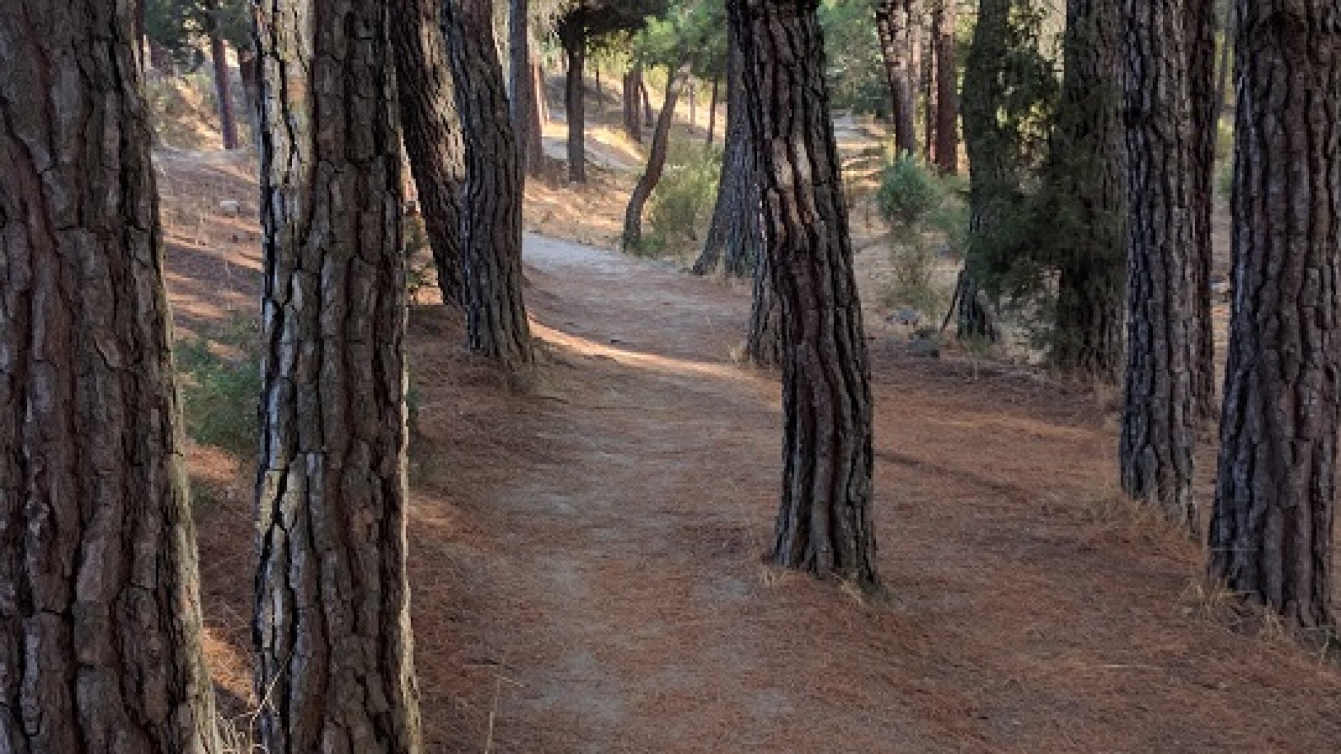
I had never been to this place before, so I didn't know what I was going to find. To my surprise the soil was quite nice to the touch when compared with other trails in Sierra Guadarrama and except for a few stretches I found a mixture of long pine needles, dirt and small gravel. The dirt was soft enough to yield for the gravel, so you didn't have that stinging feel when you walk on compact gravel.
The first half of the hike the trail goes almost parallel to a paved track. I also walked on the asphalt for a couple of stretches. It was nice to the touch and I bet it would feel great when running, however it was too hot.
Here you are a bunch of pics with comments. They are grouped by theme and don't follow a timeline.
These pictures give an idea of what the ground looked like for most of the hike:


But sometimes it wasn't that easy:


When possible, I took alternate "unofficial" trails that looked much more comfortable:

This trail here drew my attention. It's obvious water runs on it when it rains heavily. At some point the indent was about half a meter in depth:


Although the main trail is generally wide, sometimes I took smaller, wilder trails. According to maps, this one here makes part of the Spanish GR10 long-distance trail, which also makes part of the European E7 trail going from Portugal to Hungary. However the white-red marks lead you to a wider-alternate path (which is dull and rough). In the last pic you can see one of those solid bridges I mentioned with the white-red marks indicating the GR goes trough it:


This apparently is a bar in the middle of nowhere by the GR10. It says "OPEN". I didn't check it, though:

From the main area (where most bars are placed) you can take several trails. The one I followed is called "La Autopista" (The Highway). You are likely to find a lot of hikers and trail runners on it. And also cows. And donkeys:


This huge rock fell off of the top of the mountain long ago. It's known as "El Tolmo". That was my destination and where I had lunch. 13:15 looks like a good time for lunch, isn't it? Although it's still a bit early for Spanish standards:


Here I was about 1.5 km away from finishing my hike, where my scooter was awaiting for me for aride back home. You may notice some dark stains under my soles. Those are not bloody wounds, but pine resin stains!

Here you can have an idea of the path I followed:

And finally, a few views along my hike: